
Pottinger harvest app offers route maps for silage carts
Troubled by seasonal silage workers getting lost on long draws between field and clamp?
Pottinger’s Harvest Assist app now has the solution, with navigation both to a field and back to the clamp via Google Maps.
There is also the option for the number of bales produced in individual fields to be recorded by the baler operator.
Machines that Pottinger does not produce itself – such as forage harvesters, big square balers and bale trailers – can also be added to the system.
See also: What to look for when buying and fitting a tractor dashcam
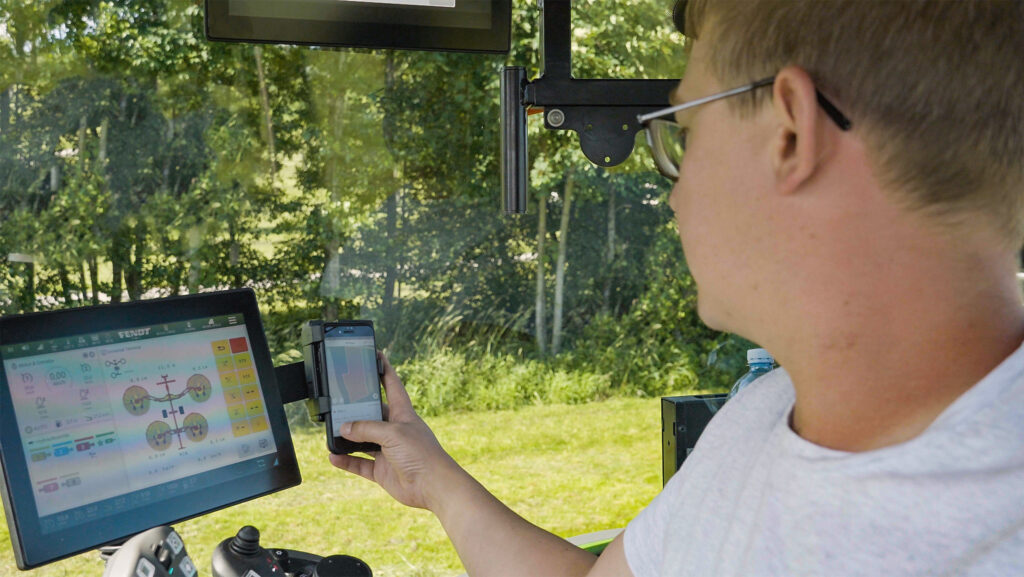
The Harvest Assist app keeps team members informed of progress © Pottinger
The free app – available for both Android and iOS devices – is “loaded” with details of fields to be harvested and its status, when mown, raked or baled, is updated by individual operators upon completion.
It is intended to streamline communications within a multi-operator team and to keep all members up to date with locations and the progress of different operations.
An optimisation algorithm takes account of harvest volume and haul distances between field and yard, to help produce a constant flow of material that allows the clamp operator time for consolidation.
In the live location view, each member of the harvesting team is shown on a map in real time, along with the relevant machine in the fleet.
