Cereals 2015: Time to map blackgrass with a drone is now

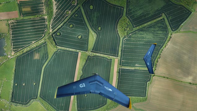
Increasing numbers of growers are using drones in the battle against blackgrass, and now is the ideal time to map patches in fields.
Interest in drones in the UK has exploded in the past few years, and the Association for Unmanned Vehicle Systems predicts that 80% of commercial drones will be used for farming.
Many farmers have invested in drones, but Alex Dinsdale of Ursula Agriculture believes they can get even more out of their aerial photos by turning them into digital blackgrass maps.
“Now is the time to map fields, as the seed heads are prominent above the crop canopy,” he says.
See also: For more news, photos, video and information on the event see our Cereals 2015 page
While farmers can generate their own imagery, he highlights that sophisticated analysis using special processing software is needed to get more out of images.
“The technology allows us to calculate the percentage of blackgrass within the crop on a 5x5m grid, or on a ‘zone’ basis.
“So not only do the maps show where the blackgrass infestations are, but also their extent and density,” he says.
Mr Dinsdale adds that mapping is really useful as patches are not always visible from the road, headland or tramline.
The data can then be fed into management software such as GateKeeper to help with decision making.
“For example, you can go in with glyphosate to knock out the plants to prevent seed being returned,” he says.
It also helps in deciding which crops or varieties to grow in following rotations, what cultivation strategy to adopt and whether to up seed rates when variably drilling crops in order to increase crop competition and help smother out the weed.
“Overlaying blackgrass maps with soil and yield maps adds an additional dimension to this data, further improving understanding and management,” he says.
Mapping also helps identify potential spread, such as when you have a clean field next to an infested one.
“You can then ensure there is no carryover of seed via straw or machinery into clean areas. Maps help farmers manage the problem,” he adds.
While Ursula offers a drone service, he says that more farmers are taking advantage of Defra’s remote crop sensing grant funding to buy their own drone.
“We are helping these farmers by processing the images to produce the digital maps,” Mr Dinsdale adds.
You can find more information for grants under the Countryside Productivity Scheme on Gov.uk. The closing date for applications is 30 June.
For more news, photos, video and information on the Cereals event see our Cereals 2015 page

