5 factors for farmers to consider when buying a drone to map fields
 © Witt/Sipa/Rex/Shutterstock
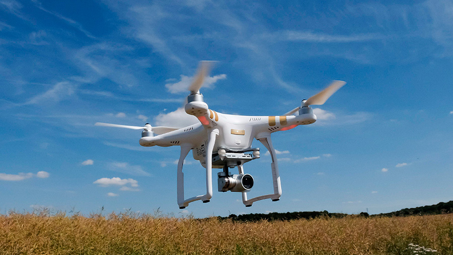
 Drones offer many benefits and can even save growers money by identifying where crops are stressed, the location of weeds as well as estimating yields.
Armed with this information, farmers and agronomists can then take action. And while drones are an efficient way of seeing large areas of crop, there are several things to consider before going out and buying one.
See also: How to stay legal when flying drones over arable crops
Here are five top tips put together by Keith Geary of Aghawk, who is organising the Drone Zone at this year’s Cereals event.
1. What types of drones are there?
There are two main types. First are the multirotors, which as the name suggests have rotary blades. Mulitrotor drones can hold a fixed position (hover) and take off vertically, making them easier to operate.
However, one downside is that they demand lots of battery power and have comparatively short flight times – normally 10-20 minutes.
The second type is the fixed-wing models, which look like planes. These types of drones have much longer flight times at about two hour and fly in constant motion.
Aghawk uses multirotor drones that are easy to operate. A lightweight camera reduces demands on batteries making them capable of flying for up to 15 minutes.
2. What is NDVI and SAVI imagery?
Live green vegetation absorbs visible light (solar radiation) as part of photosynthesis. At the same time plants reflect solar energy in the near infrared frequencies of the electromagnetic spectrum. This difference in absorption and reflection is unique to plants and to plant species.
By measuring the difference between the light absorbed and reflected by crops, the presence of weeds can be detected.
When crops are stressed, photosynthesis is affected, therefore, changing the amount of light absorbed and reflected, so this can be seen with drones too.
NDVI stands for normalised difference vegetation index and is an algorithm that can take into account conditional variations such as bright sunlight and cloud cover.
SAVI stands for soil adjusted vegetation index. Again it is an algorithm used where vegetation is low and the soil surface is exposed.
Once processed, the NDVI shaped files can be used for a variety of purposes including detection and location of weeds, counting plants and assessing crop health and biomass.
3. What type of camera is needed for aerial mapping of fields?
Within agriculture three types of cameras are commonly used:
- Standard camera – this type of camera is widely available in retail shops. It is a normal camera that produces visual images.
- Infra-red converted camera – this is where a normal off-the-shelf camera has been modified by swapping or adding a filter to improve its ability to capture infrared. This type of camera can be used to produce NDV imagery.
- Multispectral camera – this is a camera specifically designed for taking images of vegetation. Settings on these cameras allow users to take visual images and images close to the infra-red spectrum which are then converted to produce vegetation indexes such as NDVI or SAVI.
When selecting a camera bear in mind its weight. The heavier the camera, the larger the drone needs to be and the higher the cost.
A modern consumer pocket camera (such as the 16 MP Canon S110 that AgHawk uses) is sufficient to capture images that can be used for identifying problem areas.
The images taken by AgHawk drones are accurate to 1sq m while the image resolution provides information down to 2cm.
The images taken by a drone’s camera must incorporate a significant amount of overlap. They are then stitched or “mosaicked” together to create one map of the field or area.
4. How large an area can I map in a single flight and what height?
On average, 12-20ha can be mapped in a single flight, depending upon the shape of the fields and the lie of the land.
For height, 120m is the highest users are permitted to fly drones, but fixed wing drones should not be flown at less than 100m otherwise the images they capture can be blurred due to the speed at which it can travel over ground when flying down wind.
5. How are the images processed?
The images taken by the drone are first geotagged by using a log file produced by the autopilot of an AgHawk drone.
They are then stitched together or mosaicked to create one large image. This geo-referenced mosaic can then be used by other programs to produce NDVI shape files, which in turn, can be used by farm machinery for variable rate fertiliser applications.
Farmers can learn more about drone services or even fly a drone themselves at this year’s Cereals event on the 15 and 16 June. To pre-register, visit the dedicated Drone Zone webpage.

