5 useful arable farming apps on test
 © Cultura/REX
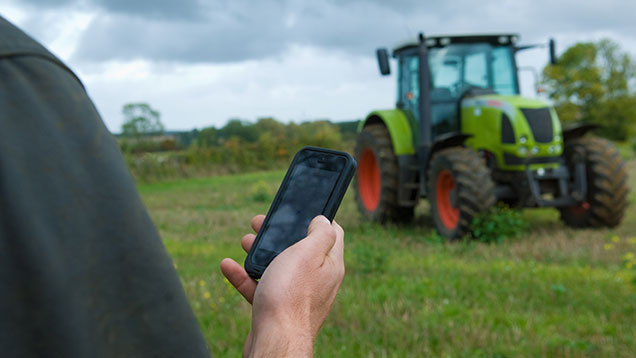
There are a whole host of apps available to download today, each claiming to help arable farmers become better organised, well-informed and richer.
We have selected five that caught our eye since we last did an arable app round-up and asked some tech-savvy growers and agronomists to see if they are worth a download.
See also: More essential farming apps for your smartphone
Planimeter
- £5.99
- iOS
 Planimeter is a handy little app directly designed with field and plot measurements in mind.
It uses the GPS and aerial maps to accurately tell you the measurements of any field, building, fence, hedge, track, pond or anything else you can see from an aerial map.
Unlike other GPS mapping apps, Planimeter does not require you to actually walk the perimeter of the field.
Instead you can park up at the field gate and remain in the comfort of your tractor cab as you swipe around the map on your iPhone or iPad, plotting the boundaries.
When you are done you can save and name the map, copy the measurements or email the entire thing to yourself.
We gave the Planimeter app to Lincolnshire independent agronomist Philip Vickers and asked him to report back.
Mr Vickers says: “This app gives you a really accurate measurement.
“It’s handy that you don’t need to actually to walk the field to get a measurement but I’m guessing the maps won’t always be completely up to date so that could be a problem.
“I’ve recently ditched my iPhone for a Samsung so it’s a shame that Android users can’t get this app too.”
Bayer CropScience Agronomy Tool
- Free
- iOS and Android
 Bayer has combined three of their well-used apps into one slick and fuss-free tool.
They have taken the WeedSpotter, PestSpotter and Bayer Product Manual apps and thrust them together to create this new offering.
Users will have the power to identify almost 100 types of weed and about 70 arable pests on the spot with this knowledgeable app.
This being a free app from Bayer, it is in their interests to push their own products so you are also offered a document library, from labels to tank mix sheets, all optimised for your mobile device.
In recent updates Bayer says the app’s filter system for identifying weeds has been simplified and they have added more close-up photos so users aren’t straining to see the important details of pests.
The company adds that users should delete any of their old apps as these won’t be kept up to date from now on.
Our Farmer Focus writer Matt Redman took Bayer’s new combined app for a spin and gave us his thoughts.
Mr Redman says: “This is a really easy use app with clear navigation.
“It gives you concise information with a selection of handy pictures showing different growth stages of weeds. I used to have a book with this information but with this app it is far easier to find out what you what to know when you’re out in the field.”
Rain Alarm
- Free (Paid version £1.49)
- iOS and Android
 This is an interesting app that alerts you when rain, hail or snow is imminent in your area.
Instead of forecasting the weather it warns using almost real-time data, which the developers claim is more precise than any forecast can be.
Users will get an alert and instantly be able to see an almost-live precipitation map of their area, with colourful band of rain sweeping the map.
This might come in handy when growers are staring at the skies and trying to plan their day.
Recent updates claim to have fixed a variety of different bugs to make the app more reliable and accurate than ever before.
There’s also a £1.49 version called Rain Alarm Pro, which is version free of irritating and intrusive adverts.
It also means you can customise notifications, interval updates and radius settings to your heart’s content.
Mr Redman already had this app downloaded to his smartphone, so he was the perfect farmer to review it for us.
Mr Redman says: “It is an interesting app to play with but I’ve found it can get quite annoying at times.
“The usefulness is dependent on the season.
“In April and May when showers are frequent, your phone will be buzzing every five minutes, telling you it’s about to rain 15km away and that drains your battery.
“I turn the push notifications off for most of the time and use it to view the pretty accurate rain forecast maps for the hours ahead.”
CanopyCheck
- Subscription service
- iOS
 A bespoke app for potato growers, CanopyCheck is a groundcover monitoring system developed by experts at Niab’s Cambridge University Farm.
Once registered with Niab, growers and agronomists can use the app to take photos of potato crops.
This means field scouts, growers and agronomists can collect in-field imagery of the potato crop canopy and submit them for groundcover analysis rather than entering the data manually online.
All photos are geo-tagged, uploaded and synchronised on the Niab CUF Potato Crop Management website.
There are many price tiers to this highly specialised service, with the basic CanopyCheck app costing £100 a crop.
You do get what you pay for however and CanopyCheck is so much more than just an app, it is an entire service package with a dedicated website for registered users.
If you opt for a more expensive package you’ll get forecasts for total and graded yields displayed as graphs and tables.
Agronomist and long-term user Graeme Ditty of Tame Valley Potatoes gave us his views on this highly specialised app service.
Mr Ditty says: “Canopy Check is a quick and easy to use application that allows me to monitor crop development across multiple sites. The data collected can then be analysed and used to determine potential crop yields and identify any periods of sub-optimal growth, allowing grower and agronomist to investigate.
“It is all in one place and neatly organised making finding information simple.”
AgDNA
- Free with subscription
- iOS
 The developers of AgDNA say this isn’t just an app for your mobile phone, it’s a “powerful mobile farming platform”.
In plain English, this is a fairly comprehensive app with farm planning, boundary mapping, equipment tracking and data sharing features.
One feature that might be particularly of interest to contractors is the tracking function which, provided everyone who’s out in the fields has AgDNA on their mobile phones, allows you to see where every plough, drill, sprayer and harvester is working at any given time.
Much like the Planimeter app, you can use AgDNA when scouting a field to measure an area, map boundaries and accurately pinpoint weeds and pests that need attention.
All the information synchronised to your free AgDNA account so any member of your team can view it on their own device or by logging on to the website.
Users can upgrade to an £18.99 monthly subscription service that allows you to increase the number of records you can save each month.
As a contractor, Mr Redman is the type of user that this app is aimed squarely at. We gave it to him to see if it’s any good.
Mr Redman says: “I’ve had a play with this app and I can see the benefits of it. I’m just not sure how ‘useable’ it is in the real world.”
Basf OSR Lodging Yield Calculator
 Although strictly speaking this is a web tool rather than an app, we thought we would include Basf’s Lodging Yield Calculator for oilseed rape as a bonus item in our app rundown.
The calculator has been developed based on Basf and Adas research into oilseed rape lodging.
It allows growers to estimate yield losses from lodging.
Once you’ve entered the current OSR market price, the tool will also tell you how much the lodging is likely to cost in revenue losses.

